By the MiamiPermitAI team · July 6, 2026 · Updated September 30, 2026
The Role of Property Survey Permit Packages in Miami-Dade

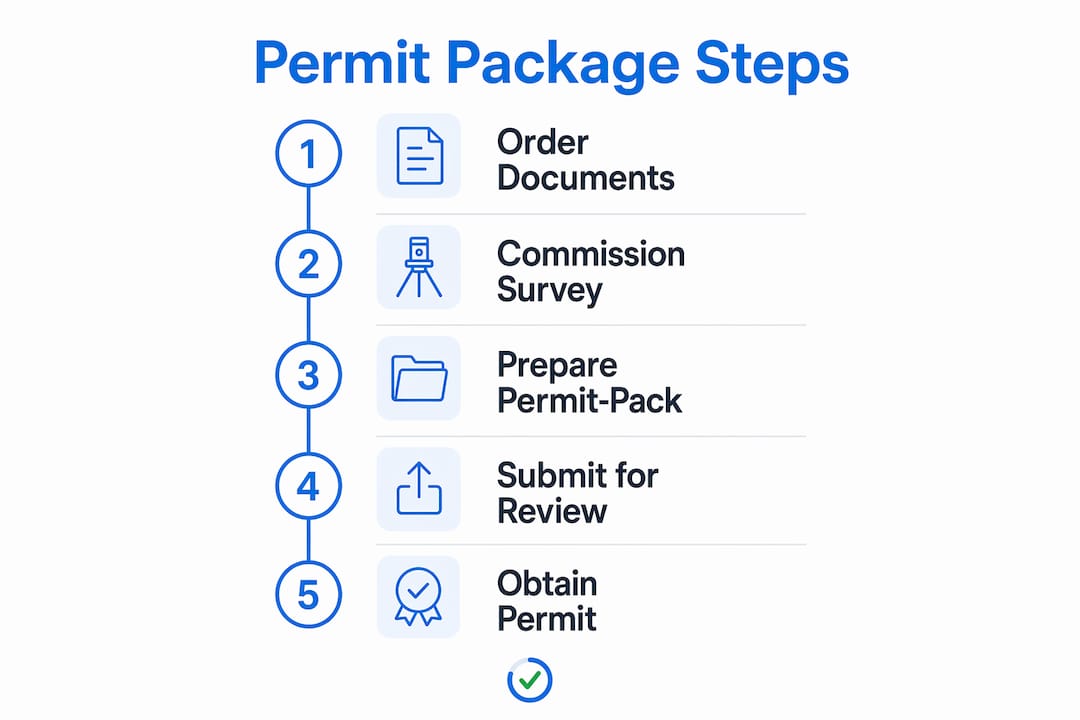
A property survey permit package is defined as a legally documented collection of boundary surveys, topographic data, and site plans that Miami-Dade building departments require before approving permits for additions, pools, and boundary-adjacent construction. The role of a property survey permit package goes beyond paperwork. It is the legal foundation that tells reviewers exactly where your property ends, where easements run, and whether your proposed structure fits within zoning rules. Without it, your permit application stalls before a reviewer reads a single plan sheet.
What is included in a property survey permit package?
A complete survey permit package contains four core components: a boundary survey, a topographic survey, an easement summary, and a proposed construction overlay integrated into a site plan.
The boundary survey defines your legal property lines using recorded deeds and plat maps. It shows where your lot begins and ends, which matters the moment you plan any structure near a fence line or property edge. The topographic survey maps elevation changes, drainage patterns, and existing features across the site. Miami-Dade building departments require topographic data to confirm that proposed construction meets floodplain and drainage standards.
The easement summary identifies utility corridors, drainage rights-of-way, and access easements recorded against the property. These are not visible on the ground. Only a professional survey pulls them from title records and plots them accurately on the drawing. The proposed construction overlay then layers your architect’s plans on top of the survey, showing setback distances, impervious coverage, and the exact footprint of what you intend to build.
- Boundary survey: Legal property lines, corners, and recorded plat data
- Topographic survey: Elevation contours, drainage features, and existing structures
- Easement summary: Utility, drainage, and access easements from title records
- Encroachment summary: Existing structures or features that cross property lines
- Proposed construction overlay: Site plan showing new work relative to setbacks and boundaries
Pro Tip: Order your title commitment and most recent deed before you commission the survey. Providing these documents upfront lets your surveyor accurately depict all easements and legal boundaries, cutting revision cycles before submission.
Why is the survey permit package vital to regulatory compliance?
Miami-Dade building departments use survey data to answer three non-negotiable questions before any permit moves forward: Does the proposed structure meet setback requirements? Does it avoid recorded easements? Does the impervious surface coverage stay within zoning limits?

Setback verification is the most common use. Under the Miami 21 Zoning Code, every structure must maintain minimum distances from property lines, streets, and waterways. A reviewer cannot confirm compliance without a survey showing exact distances from the proposed building footprint to each property line. If those measurements are missing or estimated, the application gets flagged immediately.
Easement avoidance is equally critical. Utility companies hold legal rights to build, maintain, and access equipment within recorded easements. Construction inside those corridors is prohibited and can result in forced demolition. A survey is the only document that plots easement boundaries with legal precision.
The third check is impervious surface coverage. Miami-Dade stormwater regulations cap the percentage of a lot that can be covered by hard surfaces like driveways, patios, and buildings. Reviewers calculate this from the site plan overlay, which is built directly on survey measurements.
- Setback compliance: Survey measurements confirm minimum distances to property lines under Miami 21 zoning rules.
- Easement avoidance: Recorded utility and drainage easements are plotted to prevent prohibited construction.
- Impervious coverage: Hard surface percentages are calculated from survey-based site plan overlays.
- Floodplain elevation: Topographic data confirms finished floor elevations meet FEMA flood zone requirements.
- Drainage compliance: Existing drainage patterns are documented to show proposed work does not redirect stormwater onto neighboring properties.
Submitting raw surveys instead of permit-ready site plans is the leading cause of permit delays and rejections in Miami-Dade. A survey documents existing conditions, but a permit reviewer needs a site plan that overlays proposed construction, setbacks, and impervious surface calculations. These are two different documents, and confusing them costs weeks.
How have 2026 ALTA/NSPS standards changed survey requirements?
The 2026 ALTA/NSPS land title survey standards, which took effect february 23, 2026, introduced the most significant updates to survey deliverables in years. Property owners and developers in Miami-Dade need to understand what changed and why it matters for permit quality.
“The new Table A Item 20 requires surveyors to compile detailed summaries of physical conditions and potential encroachments on the property. Combined with a reduced 5-foot proximity threshold for identifying utility features, these updates give permit reviewers far more precise data than the 2021 standards ever required.”
The key changes are:
- Table A Item 20: Surveyors must now provide written summaries of observed physical conditions and potential encroachments, not just plot them graphically.
- 5-foot utility proximity rule: Any utility feature within 5 feet of the property or proposed construction must be identified and documented, tightening the previous standard.
- Encroachment disclosures: Existing structures that cross property lines must be explicitly called out in the survey narrative, not just shown on the drawing.
For smaller residential projects, a full ALTA survey adds cost. The benefit is a defensible, legally precise document that holds up in permit review and in court. For larger additions or commercial projects in Miami-Dade, the cost of an ALTA survey is minor compared to the cost of a rejected permit or a boundary dispute.
Common pitfalls in preparing a Miami-Dade survey permit package
The most damaging mistake property owners make is treating the survey as the final deliverable. The survey is the legal ground truth. The site plan tells the construction story. Permit reviewers need both, and submitting only a survey guarantees a correction request.
Timing is the second major pitfall. Delaying survey procurement until late in the design phase regularly produces costly plan revisions. Easements discovered after architectural drawings are complete force redesigns. Topographic surprises change drainage plans. Ordering the survey at the start of project planning eliminates these surprises before they become expensive.
- Submitting a raw survey without a proposed construction overlay
- Using an outdated survey that does not reflect current site conditions
- Failing to provide title commitments to the surveyor before work begins
- Skipping the topographic survey for projects in FEMA flood zones
- Not integrating boundary and topographic data into a unified site plan
Working with a licensed surveyor who knows Miami-Dade permit requirements is not optional. The property survey application process in Miami-Dade has specific formatting, sealing, and signature requirements that vary by project type. A surveyor unfamiliar with local standards produces a technically correct document that still fails review.
Pro Tip: After pouring your foundation and before framing begins, commission a foundation survey to confirm the structure sits within approved setbacks. Catching a placement error at this stage costs a fraction of what a tear-down costs after framing is complete.
How do survey packages protect ownership and prevent disputes?
An accurate survey permit package does more than satisfy a building department. It is the clearest legal record of where your property begins and ends, and that clarity prevents disputes that can stop a project cold.
Surveys reveal exact property lines and recorded easements that no amount of visual inspection can confirm. A neighbor’s fence that appears to sit on the property line may actually encroach by two feet. A driveway that looks entirely on your lot may cross into a utility easement. Without a current survey, these conditions stay hidden until a dispute forces the issue.
| Scenario | Without a current survey | With a 2026-compliant survey |
|---|---|---|
| Neighbor boundary dispute | No legal measurement to reference | Exact property lines documented and defensible |
| Easement encroachment | Discovered during construction or sale | Identified before design begins |
| Adverse possession claim | Difficult to disprove without recorded evidence | Survey establishes continuous, documented ownership |
| Permit rejection | Missing setback data triggers correction | All measurements present and verified |
A professionally prepared, 2026-compliant survey package acts as a legal defense in both municipal reviews and neighbor disputes. The encroachment summaries now required under Table A Item 20 make that defense stronger than any previous standard allowed.
Key Takeaways
A property survey permit package is the single most important document set for securing building permit approval in Miami-Dade County, because it provides the legal measurements, easement data, and site overlays that reviewers cannot approve without.
| Point | Details |
|---|---|
| Survey vs. site plan | A raw survey documents existing conditions; a permit-ready site plan overlays proposed work and is what reviewers require. |
| 2026 ALTA/NSPS updates | New Table A Item 20 and the 5-foot utility rule make survey packages more precise and legally defensible than before. |
| Early procurement matters | Ordering surveys at the start of design prevents costly redesigns caused by unknown easements or topographic issues. |
| Foundation survey requirement | A post-pour foundation survey confirms approved placement before framing, preventing expensive structural corrections. |
| Dispute prevention | A current, compliant survey package documents property lines and encroachments, protecting owners in boundary disputes and permit reviews. |
Common reasons permits fail over survey issues
A common pattern is not ignorance. It is overconfidence. A property owner gets a survey done five years ago, assumes it is still valid, and submits it with a new permit application. The reviewer flags it immediately because the site conditions have changed, a shed was added, a tree came down, drainage was altered. The survey no longer reflects reality, and the application goes back to the start.
The second pattern is the site plan gap. Owners hand their surveyor’s drawing to a permit expediter and assume the job is done. The expediter submits it as-is. The reviewer sends it back because there is no proposed construction overlay, no setback dimensions, no impervious surface calculation. Two weeks lost, sometimes more.
What actually works is treating the survey as the first step, not the last. Get the boundary and topographic data before your architect finalizes anything. Let the survey shape the design, not the other way around. The homeowner permit application process in Miami-Dade rewards applicants who arrive with complete, coordinated packages. Reviewers move faster when the data is clean and the overlays are clear.
The 2026 ALTA/NSPS updates are genuinely useful for anyone doing serious work in Miami-Dade. The encroachment summaries and the tighter utility proximity rules produce documents that answer reviewer questions before they are asked. That is the goal: a package so complete that the reviewer has no reason to send it back.
Get your permit package reviewed before you submit
Assembling a complete survey permit package is only half the battle. Knowing whether it will pass Miami-Dade review before you submit is the other half.
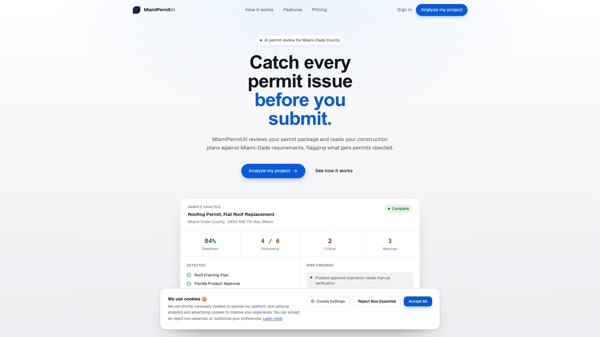
Miamipermitai checks your building permit package against real Miami-Dade requirements before you submit to the county. The platform reads your uploaded plans against Miami 21 zoning, FEMA flood zone data, and folio property records, then flags missing documents, setback inconsistencies, and the survey-related issues that most often cause rejections. You get a clear readiness score and a plain-language list of what to fix. Check your permit package before it costs you weeks of delays.
FAQ
What is a property survey permit package?
A property survey permit package is a set of documents including a boundary survey, topographic survey, easement summary, and proposed construction site plan that Miami-Dade building departments require to verify setback compliance, easement locations, and impervious surface coverage before approving a permit.
Why do Miami-Dade permits get rejected over survey issues?
Permit rejections most often occur because applicants submit a raw survey without a proposed construction overlay, or use an outdated survey that no longer reflects current site conditions. Reviewers need a site plan that shows proposed work, setback measurements, and drainage calculations, not just existing conditions.
What did the 2026 ALTA/NSPS standards change for surveys?
The 2026 ALTA/NSPS standards introduced Table A Item 20, requiring written encroachment and physical condition summaries, and reduced the utility identification proximity threshold to 5 feet. These changes produce more detailed and legally precise survey deliverables than the 2021 standards required.
When should I order a property survey for a Miami-Dade permit?
Order your survey at the very start of the design phase, before your architect finalizes any plans. Discovering easements or topographic constraints after drawings are complete forces costly redesigns that early survey data would have prevented.
Do I need a foundation survey during construction?
Yes, for most structural projects in Miami-Dade. A foundation survey conducted after concrete is poured and before framing begins confirms that the structure sits within approved setbacks, preventing expensive corrections if placement is off.
Recommended
Is your permit package ready?
Run an AI readiness check against Miami-Dade requirements before you submit.
Start your first projectThis article is general guidance and not legal, engineering, or official county advice. Always verify requirements with Miami-Dade County before submitting a permit.